• Home
  • Post a press-release
  • Visibility packages
  • Subscribe email updates
  • Event Calendar
  • Contact

For Immediate Release | Official News Wire for the Travel Industry

Where press releases are breaking news

  • Home
  • Post a press-release
  • Visibility packages
  • Subscribe email updates
  • Event Calendar
  • Contact

Magnitude 6.0 earthquake jolts South Sandwich Islands region

April 22, 2019 by Forimmediaterelease

Magnitude 6.0 earthquake rocked South Sandwich Islands region today. No tsunami warning issued.

Preliminary Earthquake Report:

Magnitude 6.0

Date-Time • 22 Apr 2019 14:49:07 UTC

• 22 Apr 2019 12:49:07 near epicenter

Location 56.265S 27.398W

Depth 95 km

Distances • 2414.1 km (1496.7 mi) SW of Edinburgh of the Seven Seas, Saint Helena
• 2549.7 km (1580.8 mi) ENE of Ushuaia, Argentina
• 2555.4 km (1584.3 mi) E of R�o Grande, Argentina
• 2749.7 km (1704.8 mi) E of R�o Gallegos, Argentina
• 2765.0 km (1714.3 mi) E of Puerto Deseado, Argentina

Location Uncertainty Horizontal: 5.1 km; Vertical 5.9 km

Parameters Nph = 63; Dmin = 618.5 km; Rmss = 0.61 seconds; Gp = 36°

Travel News | eTurboNews

Share this:

  • Twitter
  • Facebook

Filed Under: Press Release Tagged With: Apr, Argentina, Breaking Travel News, date, earthquake, Edinburgh, ENE, free, Gallegos, International Travel News, islands, issued, km, location, magnitude, MI, News articles, preliminary, Puerto, region, report, Saint, seven, South, SW, time, today, tourism, Travel Destination News, Travel Disaster & Emergency News, Travelwire News, tsunami, tsunami warning, uncertainty, UTC, warning, World News

Magnitude 6.8 Indonesia earthquake triggers tsunami alert

April 12, 2019 by Forimmediaterelease

Strong magnitude 6.8 earthquake struck 63 miles offshore of the Indonesian island of Sulawesi, 149 miles from Kendari City, South East Sulawesi, Indonesia today. A tsunami alert has been issued along the island’s eastern coast.

Preliminary Report:

Magnitude 6.8

Date-Time • 12 Apr 2019 11:40:50 UTC

• 12 Apr 2019 19:40:50 near epicenter

Location 1.852S 122.553E

Depth 17 km

Distances • 100.4 km (62.3 mi) NE of Bungku, Indonesia
• 102.9 km (63.8 mi) SSW of Luwuk, Indonesia
• 206.6 km (128.1 mi) ESE of Poso, Indonesia
• 235.1 km (145.8 mi) N of Kendari, Indonesia
• 270.2 km (167.5 mi) SSW of Gorontalo, Indonesia

Location Uncertainty Horizontal: 6.4 km; Vertical 4.1 km

Parameters Nph = 141; Dmin = 381.9 km; Rmss = 1.46 seconds; Gp = 29°

Travel News | eTurboNews

Share this:

  • Twitter
  • Facebook

Filed Under: Press Release Tagged With: Apr, Breaking Travel News, city, coast, date, earthquake, East, Eastern, ESE, free, Indonesia, Indonesia travel news, Indonesian, International Travel News, island, issued, Kendari City, km, location, magnitude, MI, miles, N, NE, News articles, offshore, preliminary, preliminary report, report, s, South, South East Sulawesi, SSW, strong, Sulawesi, The Island, time, today, tourism, Travel Destination News, Travel Disaster & Emergency News, Travelwire News, tsunami, uncertainty, UTC, World News

No tsunami threat after strong earthquake rocks South Sandwich Islands

April 9, 2019 by Forimmediaterelease

Powerful magnitude of 6.5 earthquake has struck the South Atlantic Ocean near the South Sandwich Islands today.

“Based on all available data, there is no tsunami threat from this earthquake. No action is required,” the Pacific Tsunami Warning Center said in a bulletin.

Preliminary Earthquake Report:

Magnitude 6.5

Date-Time • 9 Apr 2019 17:54:00 UTC
• 9 Apr 2019 15:54:00 near epicenter

Location 58.614S 25.357W

Depth 47 km

Distances • 2568.8 km (1592.6 mi) E of Tolhuin, Argentina
• 2576.4 km (1597.3 mi) SSW of Edinburgh of the Seven Seas, Saint Helena
• 2617.5 km (1622.9 mi) E of Ushuaia, Argentina
• 2636.3 km (1634.5 mi) E of R�o Grande, Argentina
• 2847.9 km (1765.7 mi) E of R�o Gallegos, Argentina

Location Uncertainty Horizontal: 5.1 km; Vertical 5.0 km

Parameters Nph = 119; Dmin = 838.2 km; Rmss = 0.93 seconds; Gp = 31°

Travel News | eTurboNews

Share this:

  • Twitter
  • Facebook

Filed Under: Press Release Tagged With: Argentina, Atlantic, Atlantic Ocean, based, Breaking Travel News, center, Data, date, earthquake, Edinburgh, free, Gallegos, in, International Travel News, islands, km, location, magnitude, MI, News articles, ocean, Pacific, Pacific Tsunami Warning Center, preliminary, report, rocks, said, Saint, seven, South, SSW, strong, strong earthquake, threat, time, today, tourism, Travel Destination News, Travel Disaster & Emergency News, Travelwire News, tsunami, tsunami threat, tsunami warning, Tsunami Warning Center, uncertainty, UTC, warning, World News

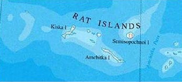
6.5 earthquake shakes Rat Islands in the Aleutians, Alaska

April 2, 2019 by Forimmediaterelease

A 6.5 magnitude earthquake struck the Rats Islands located in the Aleutians Islands in Alaska today, April 2, 2019, at 21:35:32 UTC at a depth of 19 kilometers.

The quake shook the small island of Amchitka in the Rat Islands group of the Aleutian Islands in southwest Alaska.

No tsunami threat is expected for the West Coast.

Distances:

  • 93.0 km (57.7 mi) NW of Amchitka, Alaska
  • 1204.7 km (746.9 mi) ESE of Klyuchi, Russia
  • 1310.7 km (812.7 mi) ESE of Petropavlovsk-Kamchatsky, Russia
  • 1327.8 km (823.2 mi) ESE of Yelizovo, Russia
  • 1328.1 km (823.4 mi) E of Vilyuchinsk, Russia

Travel News | eTurboNews

Share this:

  • Twitter
  • Facebook

Filed Under: Press Release Tagged With: April, Breaking Travel News, coast, earthquake, ESE, expected, Group, in, island, islands, kilometers, km, magnitude, magnitude earthquake, MI, News articles, NW, quake, rats, Rats Islands, Russia, shook, small, Southwest, threat, today, Travel Destination News, tsunami, tsunami threat, UTC, West, West Coast

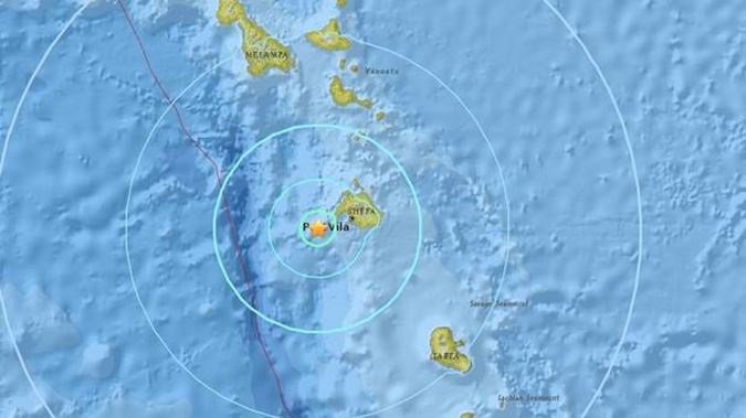
Strong 6.3 earthquake strikes Vanuatu, no tsunami warning so far

March 20, 2019 by Forimmediaterelease

A 6.3 magnitude quake struck 64 km east of Luganville on Espiritu Santo, the largest island in Vanuatu, on Wednesday, at a depth of 123 km, the US Geological Survey reported.

No information about casualties or damage is available at the moment.

No tsunami warning has been issued so far.

Preliminary Earthquake Report:

Magnitude 6.3

Date-Time • 20 Mar 2019 15:24:00 UTC

• 21 Mar 2019 02:24:00 near epicenter

Location 15.621S 167.608E

Depth 125 km

Distances • 49.1 km (30.4 mi) ESE of Luganville, Vanuatu
• 245.9 km (152.4 mi) NNW of Port-Vila, Vanuatu
• 587.2 km (364.1 mi) N of W�, New Caledonia
• 732.5 km (454.1 mi) N of Pa�ta, New Caledonia
• 733.6 km (454.8 mi) N of Dumb�a, New Caledonia

Location Uncertainty Horizontal: 7.4 km; Vertical 4.8 km

Parameters Nph = 91; Dmin = 723.8 km; Rmss = 0.82 seconds; Gp = 53°

Travel News | eTurboNews

Share this:

  • Twitter
  • Facebook

Filed Under: Press Release Tagged With: Breaking Travel News, casualties, damage, date, earthquake, East, ESE, Espiritu Santo, far, free, Geological Survey, in, information, International Travel News, island, issued, km, largest, location, Luganville, magnitude, magnitude quake, MI, New, New Caledonia, News articles, NNW, port, quake, report, reported, strikes, strong, survey, TA, time, tourism, Travel Destination News, Travel Disaster & Emergency News, Travelwire News, tsunami, tsunami warning, uncertainty, US, US Geological Survey, UTC, Vanuatu, Vanuatu travel news, warning, World News

Search


Recent Articles

  • The Bahamas Joins CARICOM Member States for Agri-investment Forum and Expo
  • IMEX in Frankfurt returns May 31 – June 2
  • Tourism Seychelles Tells its Travels Tales at the 2022 ATM in Dubai
  • CEO Schulte’s Speech for Fraport AGM Published in Advance
  • Preparations for World Free Zones Conference in High Gear – Bartlett
  • Seychelles Remains a Destination for All
  • Bahamas Delegation Travels to Mexico to Meet with Top Tourism Officials
  • Sandals Resorts Makes Their Employees Heroes
  • Normalcy Returns to Jamaica’s International Airports – Bartlett
  • Fraport Traffic Figures – April 2022: Easter Travel Boosts Passenger Numbers Noticeably

Copyright © 2022 · Metro Pro on Genesis Framework · WordPress · Log in